Attached: 1 video
I was cleaning out some old video files and I came across this gem from Associate Professor Brian Doucet at the UofW School of Planning (bmdoucet on the bad site).
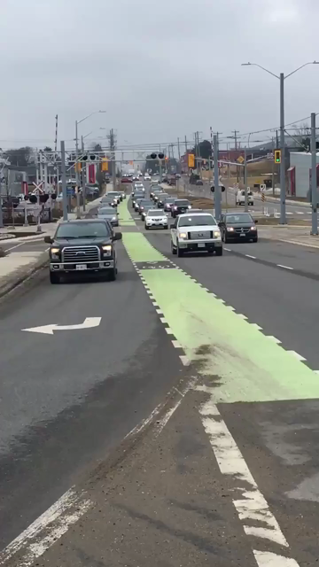
This was taken in Waterloo, Ontario, Canada the city where I went to University.
It boggles my mind that Canadian traffic engineering can be so broken that something like this gets built.
How did nobody along the path to getting this created say, "why are we building it like this when you'd have to be fucking insane to cycle here?"
Thanks for the map pin. It does a good job of showing how tight that space is but there does seem to be an island that starts south and moved north that would be a good dedicated bike path. Here’s an example of a median turned into a walkway (for my example, it would be a dedicated bike lane) that would work well in this kind of location, and probably specific to here as well. It may not be pleasant to use but it will be MUCH safer.
That’s basically what I envisioned as the centre-running bike lanes. However, the issue is how to transition on-to and off the median. And if the centre-running bike lanes extend further than the overpass, how do people get to destinations along the road?
I found in the replies, there was a proposal for a walking (potentially cycling too) bridge just south of here, but that was rejected by the province.