It’s interesting to me how you can tell red states from blue states based on how their counties are divided. Up north is nice, squared, organized. But once you get into Arkansas, Tennessee, West Virginia, the county lines drastically change to a chaotic, gerrymandered mess.
It’s not the politics, its. the geography. The counties that seem chaotic make perfect sense on the ground where the lines follow natural features in the land such as rivers and mountains.
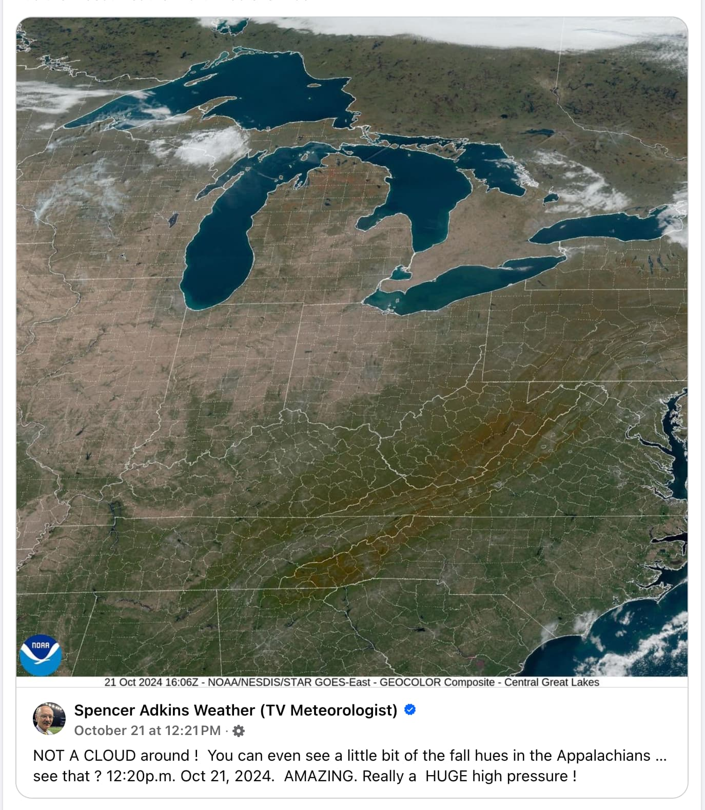
Yeah you can even follow the lines along the Appalachian, the very subject of this post. The blue north east is also very chaotic. The square boxes are mostly the midwest with very featureless flat geography, and those sparse country states tend to trend red.
I’m afraid it’s not that simple. I’m up north in Indiana. It’s very much a red state. South of us is Kentucky, which is mostly red, but it’s governor is a Democrat. East of us is Ohio, which is sort of a mix, but Republicans mostly control it. West of us is Illinois, which is really only a blue state because of Chicago. Most of the rest of it is red. Finally, north of us is Michigan, which is a blue state but also full of crazy right-wing militias, a group of whom got caught with a plot to kidnap the governor. Not sure if they have been convicted yet.
I wonder why there’s such a drastic change between those states then. And it seems like there’s a clear line where it falls apart, so I chalked it up to party influence.
It’s like the Midwest where the land is flat and everything was planned out on a map ahead of time, is laid out in a grid.
However anywhere with mountains, meandering rivers, earlier settlement before map planning, is laid out by settlement patterns strongly influenced by natural features
I’m surprised no one has brought it up so far. This is from way back when the US was still expanding east to west. Land Ordinance of 1785
It was literally just a means of dividing up the land to make it easier to manage. This is why much of the plains states follow such rectangular county/state lines between water geography.
Edit: States that had their counties/borders established before this act will have more organic geography following boundaries. Counties/States settled after 1785 will display this grid-like pattern.


It’s interesting to me how you can tell red states from blue states based on how their counties are divided. Up north is nice, squared, organized. But once you get into Arkansas, Tennessee, West Virginia, the county lines drastically change to a chaotic, gerrymandered mess.
It’s not the politics, its. the geography. The counties that seem chaotic make perfect sense on the ground where the lines follow natural features in the land such as rivers and mountains.
Yeah you can even follow the lines along the Appalachian, the very subject of this post. The blue north east is also very chaotic. The square boxes are mostly the midwest with very featureless flat geography, and those sparse country states tend to trend red.
You do know that voting district lines and County lines aren’t the same thing, right?
I’m afraid it’s not that simple. I’m up north in Indiana. It’s very much a red state. South of us is Kentucky, which is mostly red, but it’s governor is a Democrat. East of us is Ohio, which is sort of a mix, but Republicans mostly control it. West of us is Illinois, which is really only a blue state because of Chicago. Most of the rest of it is red. Finally, north of us is Michigan, which is a blue state but also full of crazy right-wing militias, a group of whom got caught with a plot to kidnap the governor. Not sure if they have been convicted yet.
Hmm… Then maybe I’m full of shit.
I wonder why there’s such a drastic change between those states then. And it seems like there’s a clear line where it falls apart, so I chalked it up to party influence.
Geography, like others have already told you.
It’s like the Midwest where the land is flat and everything was planned out on a map ahead of time, is laid out in a grid.
However anywhere with mountains, meandering rivers, earlier settlement before map planning, is laid out by settlement patterns strongly influenced by natural features
I think it’s a rural vs. urban thing mostly.
I’m surprised no one has brought it up so far. This is from way back when the US was still expanding east to west. Land Ordinance of 1785
It was literally just a means of dividing up the land to make it easier to manage. This is why much of the plains states follow such rectangular county/state lines between water geography.
Edit: States that had their counties/borders established before this act will have more organic geography following boundaries. Counties/States settled after 1785 will display this grid-like pattern.