
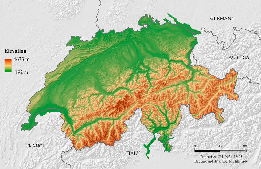
For example on wikipedia for Switzerland it says the country has an area of 41,285 km². Does this take into account that a lot of that area is actually angled at a steep inclination, thus the actual surface area is in effect larger than what you would expect when looking onto a map in satellite view?
That would work for the perimeter, but not for the area.
It works exactly the same!
edit: With the assumption that we now measure inclines of course. If measuring area of the flattened overhead projection (the current normal way) we don’t get fractal effect.
If I go over our parking lot with a 1m^2 granularity, I get 100m^2. If I go with 1cm^2 granularity, I get 110m^2 because I catch the sides of the curbs, potholes, etc.
https://demonstrations.wolfram.com/3DSnowflakeFractals/
I interpreted your reply to njm1314 as meaning “we don’t need to measure inclination to cheat, we can do that by simply increasing our precision”
I see! Then I understand your response. :)
Fractals are self-replicating while surface area or coastline of a country are inherently finite. You could very accurately measure the surface area, but there’s no reason to do that.