

It’s a Bluesky link but he use adult tags as de facto “spoiler” tags. The problem is that content is hidden if you’re not logged into Bluesky. Here’s a Bluesky mirror site to show the entire thread…
https://subium.com/profile/c0nc0rdance.bsky.social/post/3kpkcq2ecws22
A huge hint…
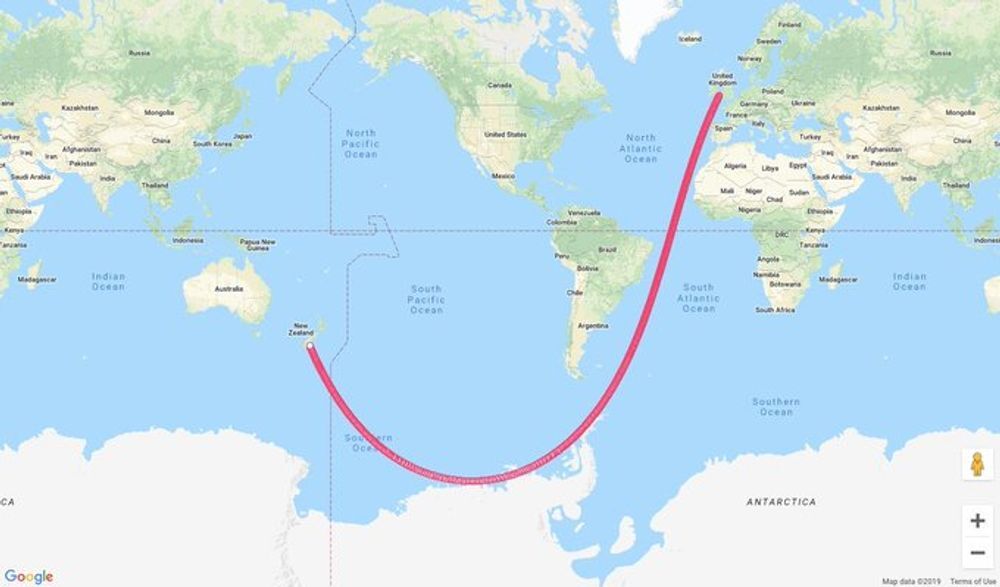
Yes, using lat, long, and radius is better than xyz on the earth - usually. But the radius, the 3rd dimension, changes by where you are because the earth isn’t actually a sphere. On this path it would get longer until you reached the equator, shorter until the most southerly point then longer again until you hit NZ. It is a wavy line not a straight one. Again you’re projecting 3d onto 2d (because you’re incorrectly assuming a fixed radius) and saying that that error in projection doesn’t matter.