The comment I replied to was talking about spy tech, I was pointing out that the photos were from a commercial satellite, whose specs are likely well known.
Hey, and you’re right about that. It’s what I get for commenting on stuff with 4am insomnia.
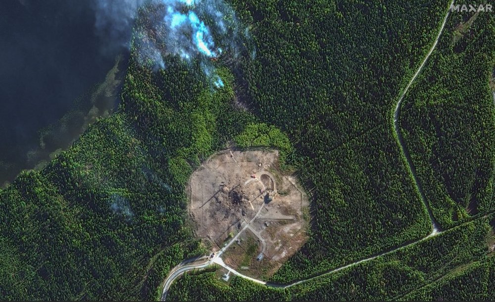
The photos are clearly credited to Maxar Technologies, which for some reason I know to be a satellite imaging company. (Yet I can’t remember my own zip code without thinking about it.)
This is from a commercial satellite though.
Are you trying to say the Google maps imagery is not commercial satellite data?
That’s correct. Google Maps imagery is not satellite data, it’s airplane photos.
The comment I replied to was talking about spy tech, I was pointing out that the photos were from a commercial satellite, whose specs are likely well known.
Hey, and you’re right about that. It’s what I get for commenting on stuff with 4am insomnia. The photos are clearly credited to Maxar Technologies, which for some reason I know to be a satellite imaging company. (Yet I can’t remember my own zip code without thinking about it.)
I think maxar might even be the company Google licenses the Google Earth imagery from