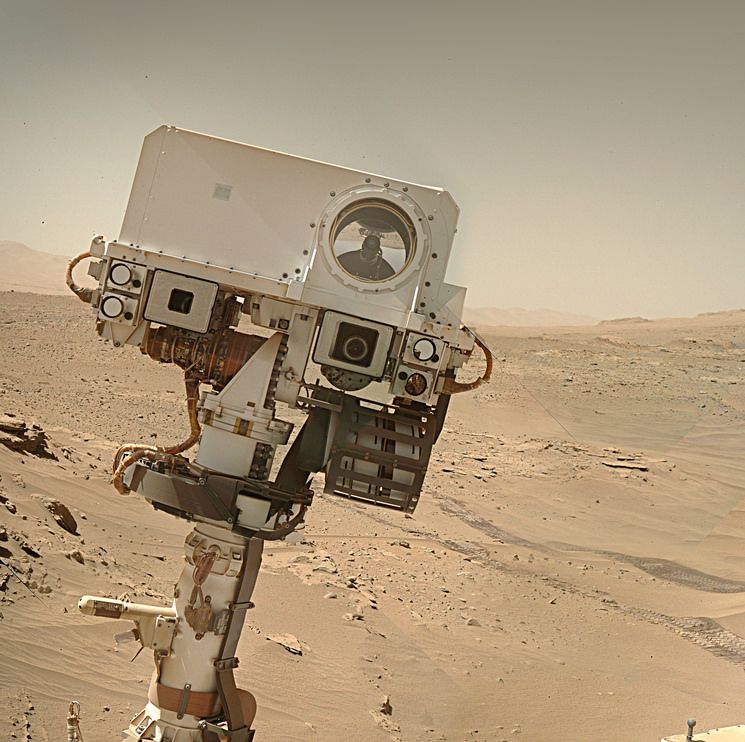
24 overlapping R-MastCam images form this mosaic (assembled in MS-ICE) Reduced by ~50% to meet upload limits
You must log in or register to comment.
It’s kind of hard to tell what we’re looking at. When were the pictures captured? What is the scale? Is Curiosity captured in this imageset? Are there any coordinates of the center image?
We’re looking at the robotic arm workspace directly in front of the rover.
The images are from sol 4132. Timestamp range: Mar 21 2024 19:52:32 UT to 19:55:07 UT
I don’t have access to the true scale, but the workspace is close to 2 meters wide
I do not know how to calculate the exact coordinates of the center of the image, but the rover is at E: 8144783.561, N: -283373.013 (Easting / Northing) or Lat: -4.78067413, Lon: 137.40742510 (Latitude / Longitude) You can just make out part of the rover at the bottom of the mosaic, so the workspace is 2.5 meters from the center of the rover. The rover’s attitude at the end of the drive was 166.07° (~SSE)
Thanks for posting and replying. If I’m reading correctly, the longest rock in the center is approx. 1 meter long?
Agreed close to 1 meter :)
That’s awesome. When I was first looking at this I was thinking it was satellite imagery. Thanks for clearing that up and awesome post!
Woah. That rock sure does look a ton like it was formed via a sedimentary deposition! Those striations are amazing.