
This is a render of a normal paper map showing the geology of Iran created by @geo_spatialist on Twitter.
Iran has a dark history of CIA and MI6 involvement which lead to the coup d’état against him – after he had implemented policies that threatened the profits of British Petroleum.
You must log in or # to comment.
Very beautiful! Is somebody here competent enough to provide some nice insights one can gain from this map?
I just have two:
- I think most people are not aware of how mountainous Iran is. This map very nicely shows that.
- In the northeast of Tehran one can see a large red part which shows magmatic rock. This is Damavand, the by far(!) highest mountain of Iran with roughly 5600m above sea level – all other mountains in Iran are below 5000m. It is also the highest volcano of Asia (or the second highest, depending on the definition of volcano).
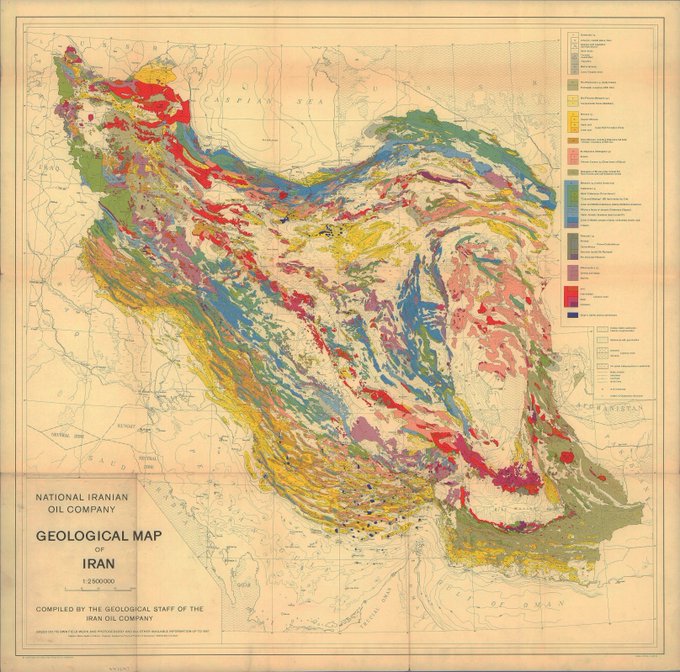 This is the original map that the render is based on.
Why is your name that?
I just find the asassin Hillary memes quite funny, also she’s a kween don’t @ me.
